When I was around ten, my dad had this great idea to backpack 12 national parks in 12 months with my brother and me. We were going to go all over the Midwest with me recording our journeys on a Flip video camera and my dad writing about it on a blog. Fourteen years and no backpacking trips later (at least for that project), my husband, Henry, and I set off on what I assume will be an equally successful project: hike the Appalachian Trail.
About a month ago (early July) I hung a map of the AT in our living room, and we planned to get Henry hiking boots and gear so that we could start section hiking the trail. A month went by. I started to get a little nervous that this map would hang, shaming us, until we took it down — not having walked any of the trail.
But last weekend (August 2, 2020) we were facing the prospect of another empty weekend. You see, o’ reader from the future, it is the year 2020 – the year we weren’t allowed to go to pub trivia anymore or have friends over to play Bocce ball. To combat our boredom, we thought a 10+ mile hike would be…fun? If we had even one puzzle left to put together or a sourdough starter, we might never have gone hiking at all.
We left the house around 4:30 in the morning, leaving Luna, our dog, very confused. McDonald’s for sustenance was obviously a must, and in the dark we drove separately towards Gathland State Park. In order to section hike the AT – if you don’t want to walk the trail twice – you either have to have two cars (one parked at each end) or a non-hiking friend to pick you up and drop you off. For any spouses thinking about doing this, I do recommend the two-car method. It’s kind of nice to listen to your own music without your sweetheart after you’ve walked with them, and only them, for the last fiveish hours.
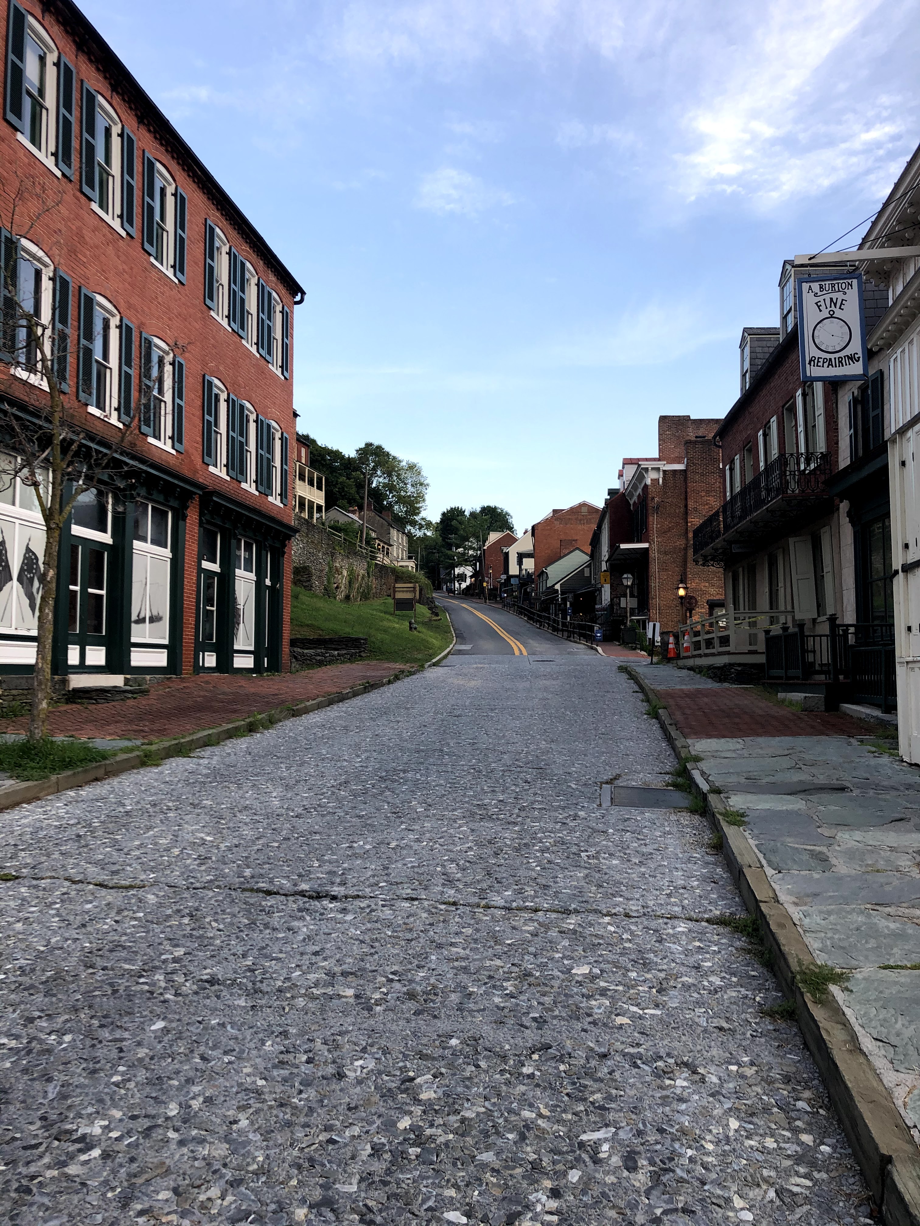
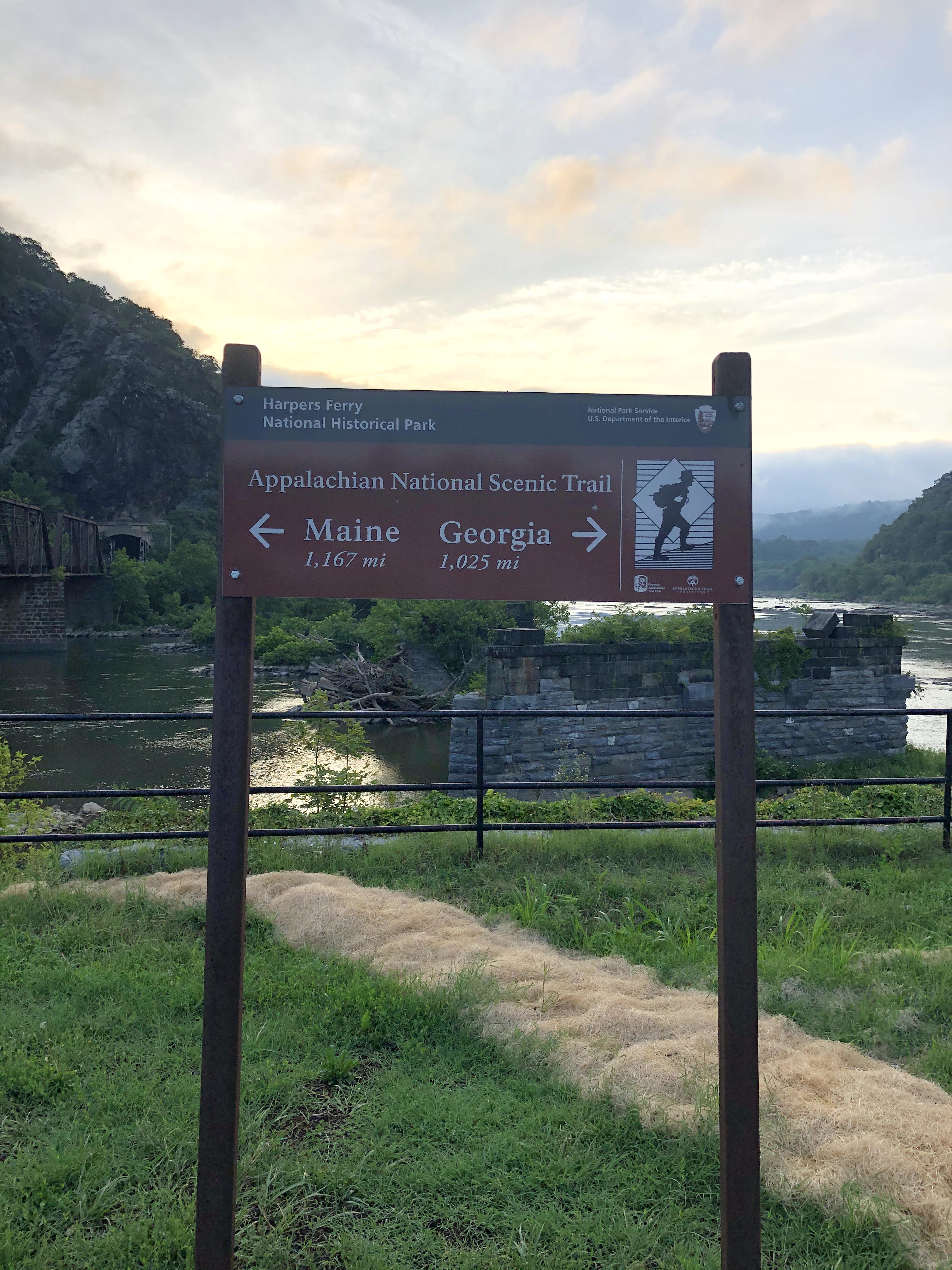
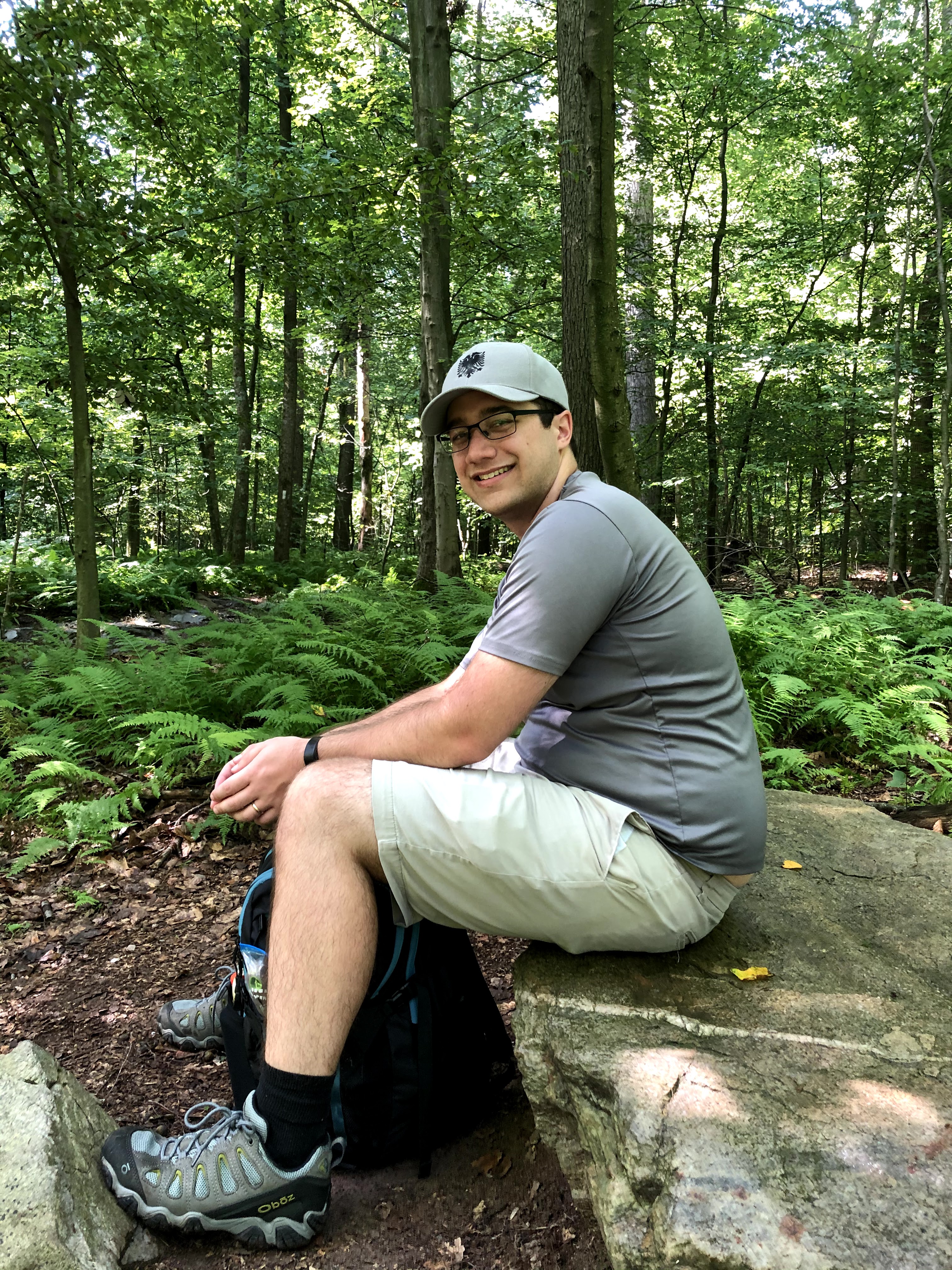
After leaving my car at the Gathland South Parking lot, we drove 15 minutes to Harpers Ferry, home of the Appalachian Trail Conservancy Headquarters. You have to download their parking app to be able to park on the streets, which was almost an issue because service was terrible. If you’re thinking about going there, download the Parkmobile app first. We walked down the main street up towards the Conservancy building – closed at 6:15a.m. for some reason. We took a selfie, and I started to daydream about what the picture will look like when we end our AT adventure coming from the opposite way. Will it be five years from now or fifty?

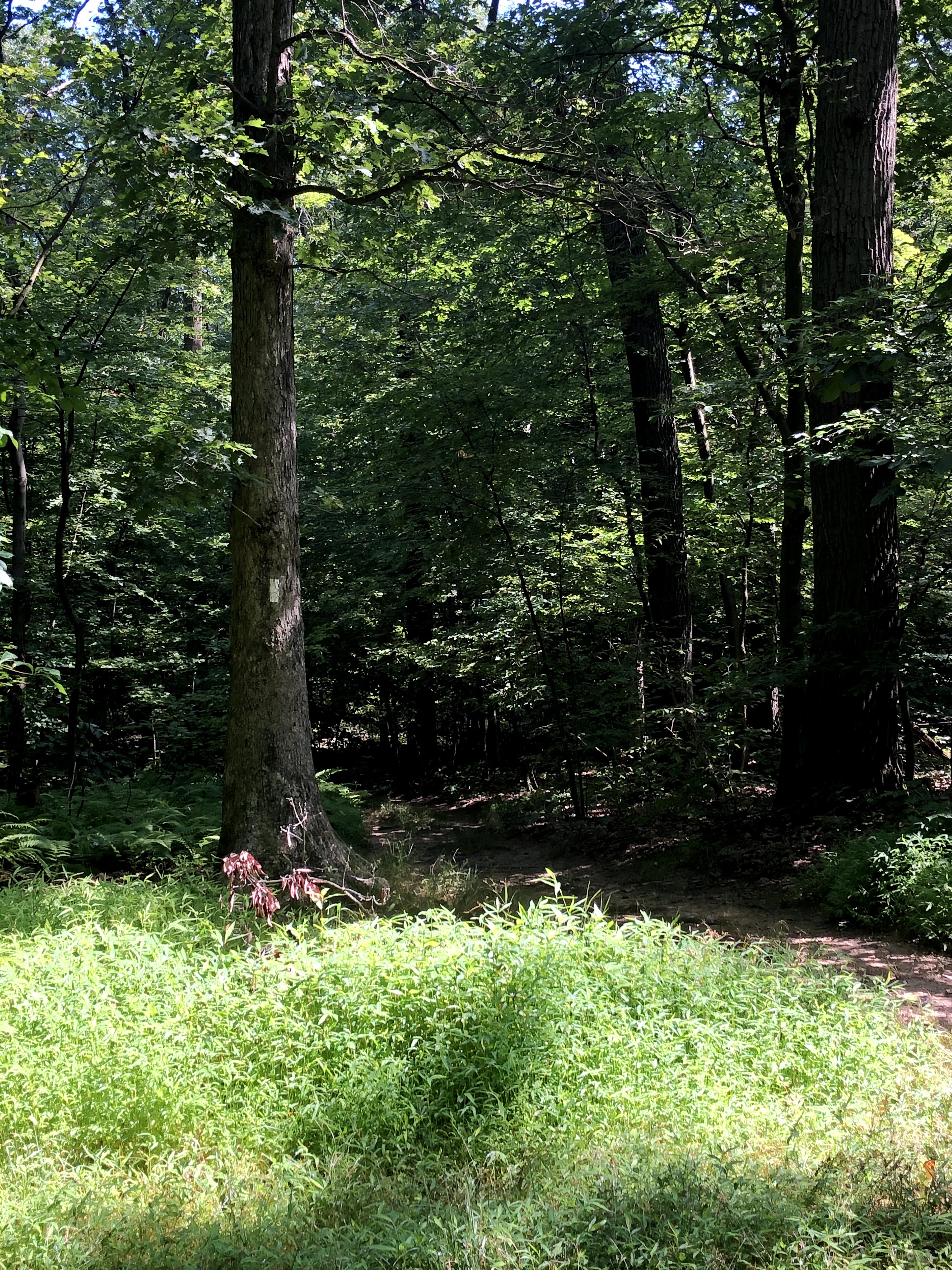
It took us a bit to find the trail from Headquarters. We followed what I thought were white blazes but turns out they were blue — the trail itself never goes by the AT building, but there is a side trail from the main trail, which we were on. We curved behind a building (looked like private property so Henry was nervous but I was pretty sure we were going the right way) and found the stone steps that lead down to the trail. Just like that, we had taken our very first steps on the AT.

Being the first ones out that morning, I took down all the spiderwebs with my face and body for all the other hikers. For about a mile I was just picking at my face and arms trying to get the silk off me. Henry, very gallantly, brought up the rear to make sure I wouldn’t come to any harm. He mentioned he didn’t feel any of the spiderwebs. Weird.
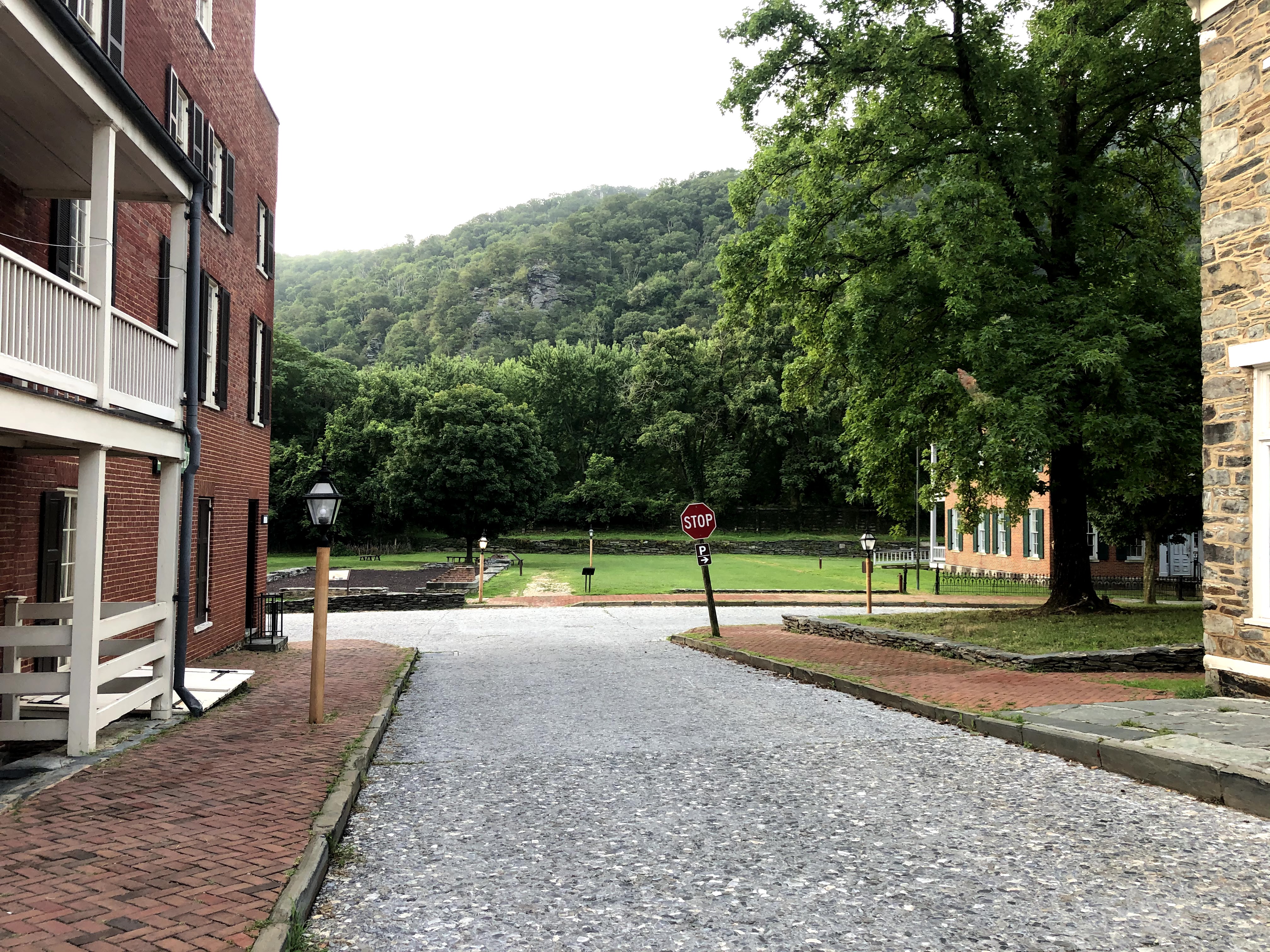
The trail from Harpers Ferry to the Maryland border is rocky at first. Most of it seemed to be rock steps, and if it had been even a little dewy it would have been treacherous. On the way down, we passed three deer — a mum and two spotted fawns. The fawns jumped out of our way quickly, but the doe kept her eyes trained on us until we disappeared over another crest. After a little while on the trail, you come back into Harpers Ferry, where you have to walk past a ruined church and then past another one, albeit functional this time. You walk past a few old shops and a large park, where, amazingly, there were five more deer. They actually followed us for a few seconds. Henry had to remind me deer were herbivores.
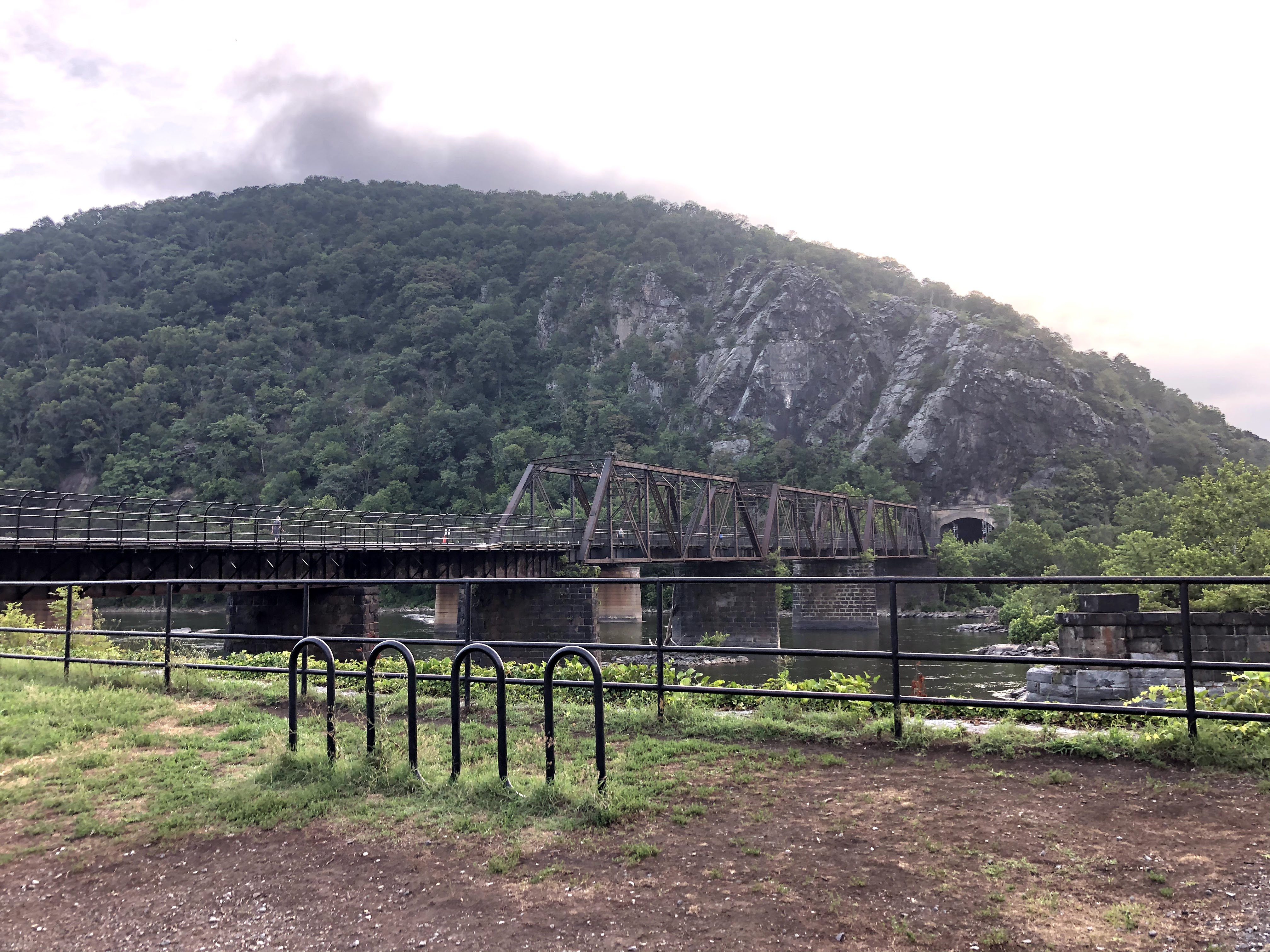

After getting all the way through town, you walk along a bridge that takes you over the C&O Canal. People have left love locks on the bridge — sometimes precariously far away from the path where they would have had to climb over the railing to get the lock clipped there. Following the bridge is a metal spiral staircase that sets you down on the Maryland side of the trail. It was the nicest section of the trail we walked on, and it reminded me of our honeymoon to Prince Edward Island. The trail was wide enough for four people to walk side by side, and there were lots of cyclists out. We didn’t think that we could get six feet apart comfortably so we did mask up every time someone passed us. Thankfully, it was still early in the morning so we didn’t have to very often.
After a few miles of this, probably four miles or so into the section, you have to cross a road and the trail narrows. We passed a family preparing to hike somewhere, but we never saw them after we walked past — and we took a lot of breaks. Our ritual was stop for water every mile and exchange the backpack every two miles. Next time we might split the weight into two backpacks, but it was also really nice to go backpack-free for two miles at a time. The heaviest parts of our backpack were the water bottles and bladder. We brought five liters with us and ended with a liter left over.


Once the trail narrowed, we couldn’t walk side by side anymore, so Henry had to walk at my pace, which slows down a lot when I’m walking over rocks. I’m very afraid of falling and cracking my head open, which longtime blog readers might be surprised to hear about given my Norwegian and Northern Ireland escapades. I was also on the lookout for black bears because a friend of ours had said he saw four of them while backpacking himself. It was only around mile eight or nine that Henry said our friend had only seen black bears while off a trail.


We stopped halfway for food and water. In our backpack were four sandwiches, two bags of candy, a bag of beef jerky, and a box of cliff bars. We were ready to either get stuck out in the wild for a few days or to have a feast on our way home. I had a few bites of jerky, and Henry ate a cliff bar. For the rest of the trail, we were under dense cover. We started to see more and more people walking dogs or hiking with little ones. I was surprised that we didn’t see anyone who looked like a thru hiker. Maybe they’ve all already come through Maryland, or no one has yet?
With less than a mile to go, we finally saw the parking lot where we had left my car. We found the exit to the lot, rounded around “The Empty Tomb” and made it. Henry took his boots off and revealed two half-dollar size circles on the backs of heels where the new boots had torn away the skin. He still hasn’t recovered. We drove him back to his car, both separately went through drive-thrus again for soda and made it back home where we showered, napped, and sharpied the AT map on the wall.

Oh, you can’t see it? Here’s a close-up.

Before and After Pictures:


| Miles Completed | 10.7 |
| Miles to Go | 2179.3 |
| Percentage Complete | 0.4% |

Congratulations on your first 10. At the rate you are walking you only have about 5100 more hours to go. The pictures are great and you guys didn’t look any the worse for wear at the end of the trail. Look forward to narratives on the next 200 miles!!
LikeLike