You are an elderly gentleman mentally preparing for a hike in the beautiful Gathland State Park. Sitting in your truck, you wonder to yourself if the rain will make the trail impassable. The rain is lighter than it was, sure, but maybe the trail will be too wet for knees like yours.
A grey Honda Civic rolls into the parking lot and out pops a young couple. The man is wearing a grey athletic t-shirt and khaki shorts, his female partner a blue hat, red tank top, and green cargo pants with Christmas themed socks pulled up over the legs of the pants. They each stare at their phones for a few seconds (kids these days) and then head off around the Tomb Monument towards the back of the trail.
Not a minute later, they pop down from the trail again (a different entrance) and start off down the road. You roll down your window, “Hey, is the trail closed?” you call out.
“Nope!” They say together, and nothing else, and start walking towards the road instead of the trail. You (probably) roll your eyes.
I was excited to write that little scene the moment it happened. So Gathland State Park, when coming into the South Parking Lot, has two entrances to the Appalachian Trail: one directly behind this empty tomb that has a brick archway and another about 200 feet down the trail that actually slopes into the parking lot. When we got off last time, we did not know about the other entrance, so we came down under the arch. I assume it was really amusing to watch us go into the woods and immediately come back out again.
It was raining, but lightly. We got out on the trail before sunrise, but while it was still bright enough to see. Fog covered the hills around us, though we could only see it briefly before crossing Gapland Road. On the right, we passed a War Correspondent’s Memorial, and on the left, a shelter that said we could only use it if we had a permit. Since there were very few trees around, the white blazes were scarce. Henry found the blaze at the opening of the woods, and we started the hike for real.
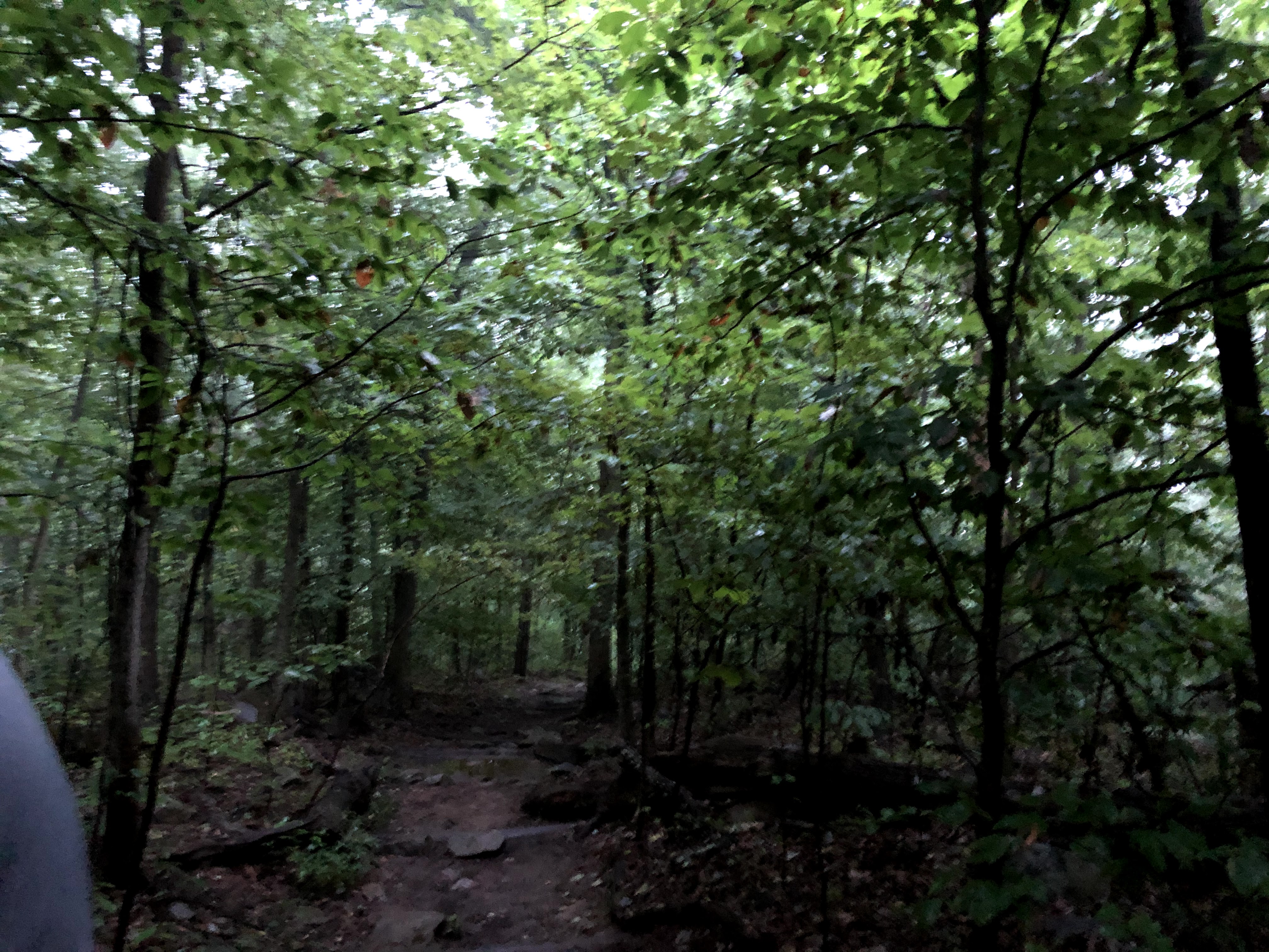
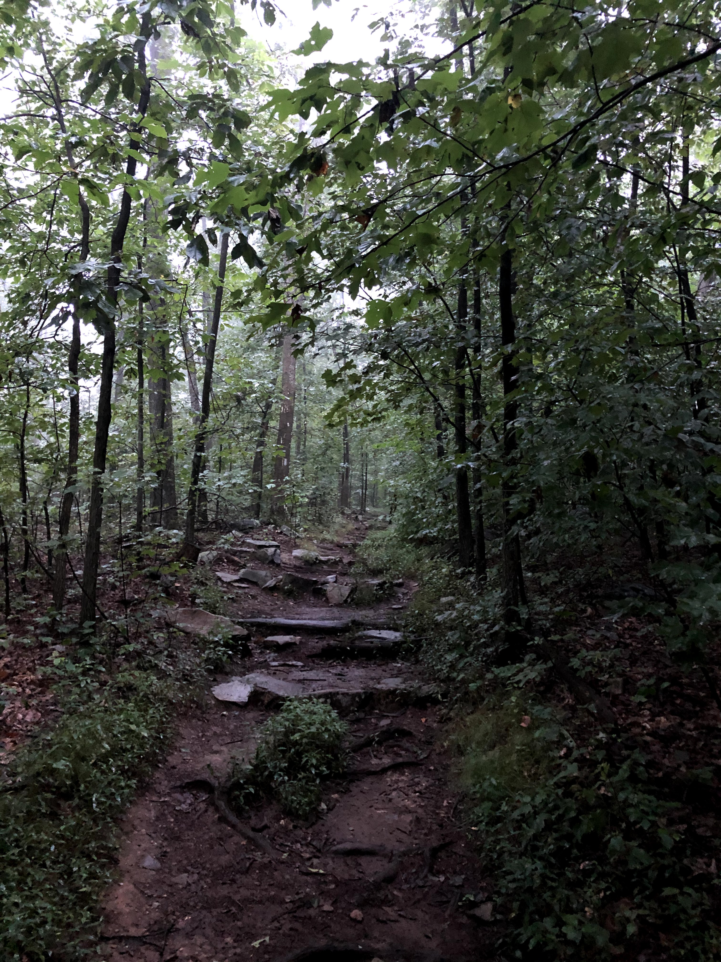
We had trash bags in our pack in case the rain got worse, but it was never more than an intermittent sprinkling under the trees. The first section of our hike, the first four or five miles, was steep. Without the manicured bike path of our first hike, the jump into rocky and challenging terrain from the beginning was tough, and we spent the first couple miles in silence, only broken by heavy breathing.
I’m not a clumsy person by nature, and I don’t fall all that often, but I’m very scared of falling down (though not afraid of heights). Whether I’m on ice or slick rocks like I thought these would be, my pace slows, hands fan out, and I walk like a toddler. Needless to say, I was on spider duty again, otherwise Henry would have gotten miles ahead of me.
One of the places we passed which is noted in our Thru-Hikers’ Companion is White Rocks Cliff (noted in the book as White Rocks Cliff…view, reminding you not to sleep on very tall rocks). It provided some very pretty pictures, and if it hadn’t been 7 in the morning, would have been a great place for lunch.


Our halfway point was the end of a private asphalt road the trail was running parallel to. Across Reno Monument Road the trail picked up again, but the asphalt made a perfect bench. Across a field was a monument I just looked up: Major General Jesse Lee Reno Monument (Union, thank the Lord). By this time, the sky had cleared up and the sun was shining, but we did not yet know what evil it would bring. At the time, it just meant we could eat some peanut butter and jelly sandwiches without getting wet. If we were actually backpacking – taking multiple days and camping at night – we would take much longer lunches than we do on these day hikes. Normally we sit for about fifteen minutes and rush through some food. If we were backpacking, I’d want to spend closer to an hour resting, take my shoes off, and maybe read a little before heading back on the trail.

Deep back in the woods, we walked by the Dahlgren Backpacker Campground which had, get this, two actual bathrooms with running water and two benches outside. If we had been backpacking, this is definitely where I would have wanted to stop for the night. I really don’t know how they got this built – it is pretty far into the forest.

The cool woods and occasional spray of rain actually meant that this hike, so far, was more comfortable than our last hike. The last hike was hotter and much sweatier. But the sun wasn’t going to let us alone for long.

Coming out of the woods, we passed Old South Mountain Inn on our left (adorable) and to our right was the Church of St. Joseph and the Sacred Heart of Jesus (obviously the parish council came to a tie when trying to decide the name). It was actually a very cute church with no parking lot or feasible way to get there except to walk across a field. The only thing this field needed to make me feel like I was back in England was sheep.
But the field was treeless and exposed to the sun. In the course of ten seconds, we went from perfectly comfortably to imperfectly miserable. And it was my turn to hold the backpack. Every step became a chore, and it was impossible to focus on anything besides how hot it was. Even when we finally made it back to the trees, they were spaced so far apart that sun was still getting through.
This is where we were in terms of gaining elevation:

It was nearly time for Henry to take the backpack (we switch every two miles). When I asked, I was .05 miles away from him taking it. Every ten steps or so I started grunting “Come on!” meaning “be .05 miles already!” Finally Henry said, “8 miles!” and I unclipped the backpack and meant for it to the drop to the ground but the straps stuck to my shoulders.
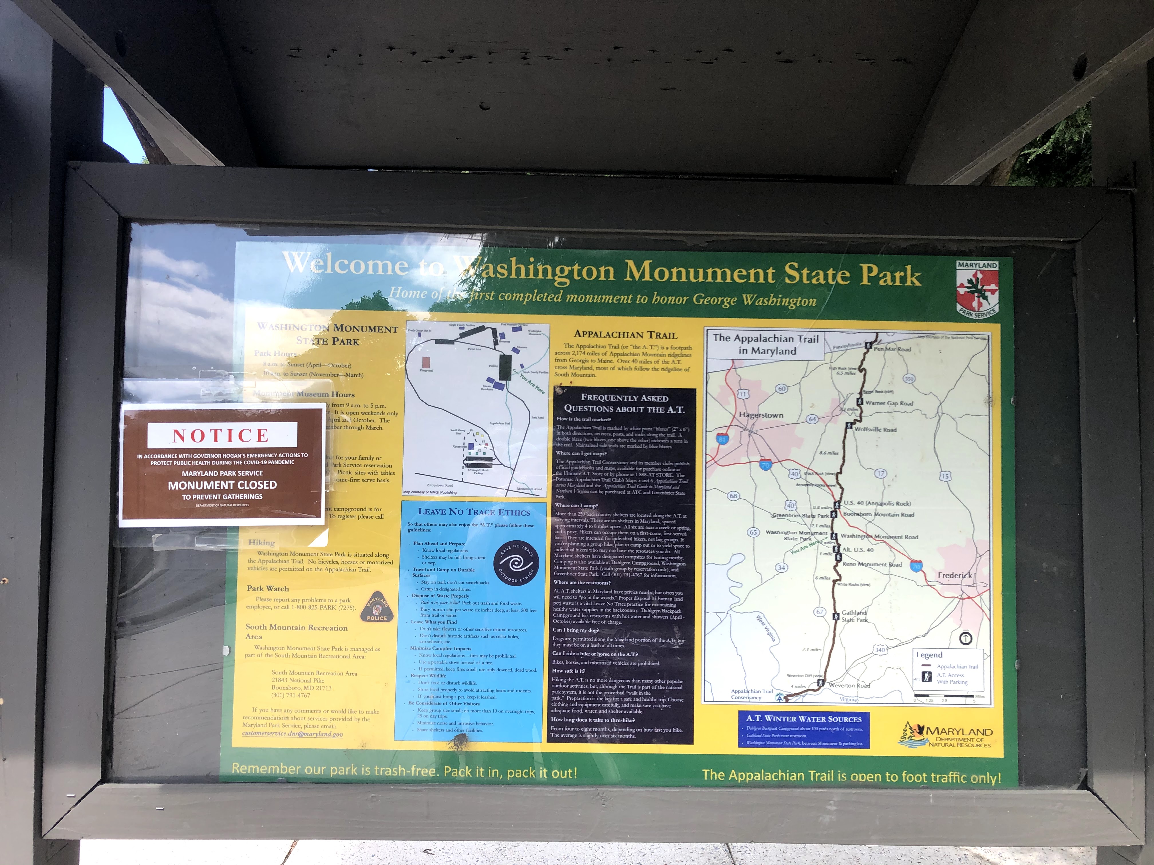
The sun’s oppression didn’t last long after that and we got back into the woods. These miles went by more quickly and so will the rest of this blog post. We crossed Monument Road (these folks REALLY love their monuments and naming roads after them). We entered Washington Monument State Park; I don’t think we ever actually saw the monument, but we were treated to several placards with fun facts about George Washington.

At one point, we passed a little stone shelter with picnic benches whose sign read “Mount Vernon.” Henry looked at it and said, “I don’t believe you…” if that gives you any indication to how hiking 10+ miles was treating us emotionally at that point.
Then there were lots of trees and rocks. I took to having conversations with the AT (seriously, maybe 13 miles wasn’t the best idea). “Now, I thought we said we were done with rocks,” I told the trail. “Why would you put a tree there?” A couple times Henry said “What?” behind me and I had to explain I was talking to the ground and not to him.
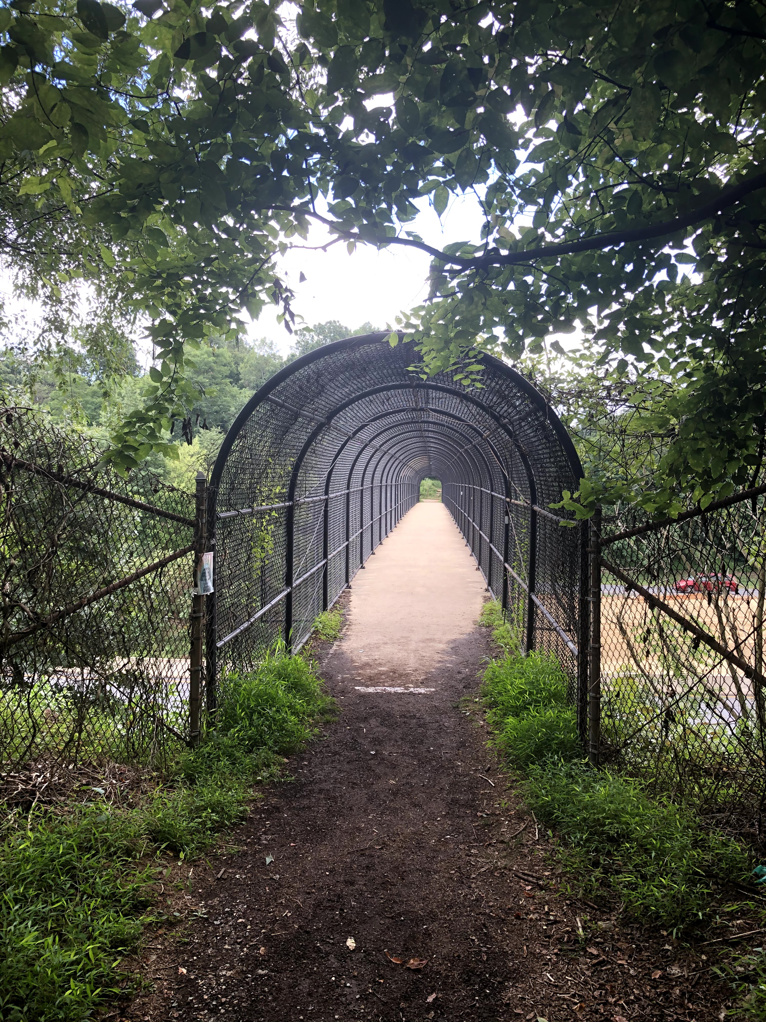
We crossed Boonsboro Mountain (not Monument) Road and through the properties of two houses – one of which had set up a little bench by the trail, so nice. After descending very steep steps – thankfully not wet – we came to the I-70 footbridge.
There was a family coming from the other direction, a dad, mom, and probably 8 or 9 year old girl. Dad went to check out the locks that had placed in the shape of a heart, and the young girl put her toe down on the bridge and immediately stepped back. Put a toe down, jumped back. Repeat. When we passed them (masks on), I heard the girl yell to her mother, “I’m scared!!”

It reminded me of a time I was in the mall in St. Charles, MO, with my mom and maybe brother. We were on the second floor heading down via the escalator. I don’t remember the moment too well, but I can clearly see in my mind my mom going down the escalator and me remaining at the top – scared to get on. My mom will claim it was an accident that I was left at the top and not on purpose.
Crossing the footbridge meant we were a hundred feet from the parking lot and effectively at the end of our hike. We took six hours and two minutes to complete 13.05 miles with an average pace of about 27 minutes per mile (we did not stop our watches during lunch so that is factored into the pace too).
Before and After Pictures:


| Miles Completed | 23.7 |
| Miles to Go | 2166.3 |
| Percentage Complete | 1% |
