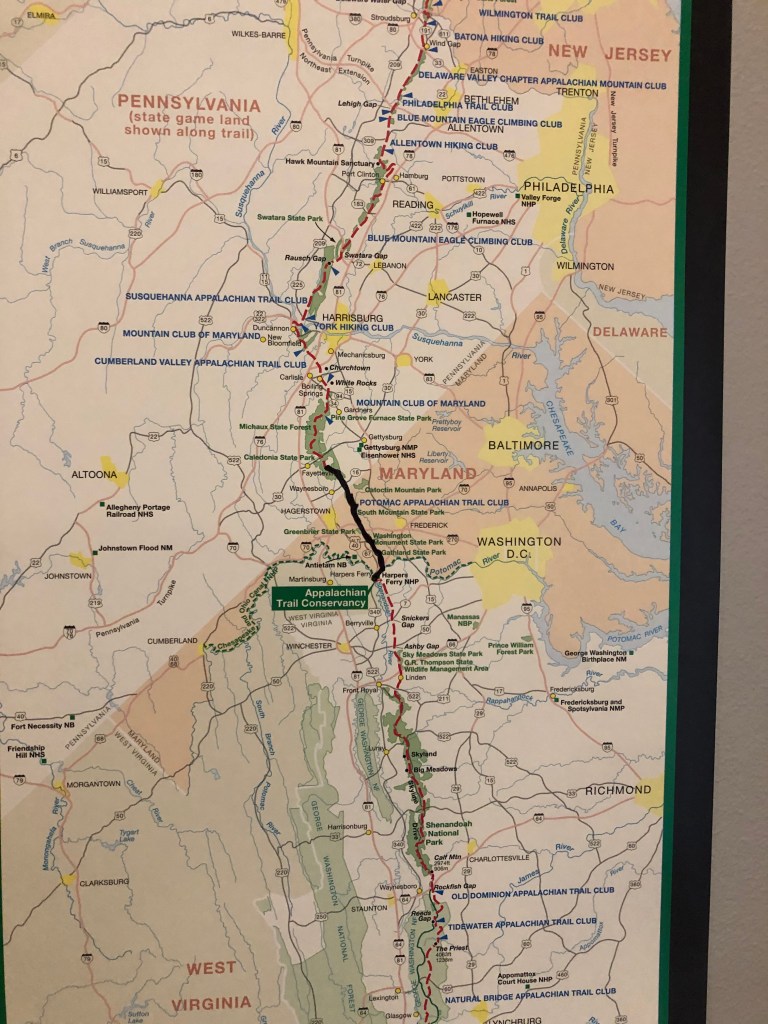
Originally, we were shooting for PA 233, which on my map, my copy of the Thru-Hiker’s Companion, and Google Maps say has about two parking spaces along the AT. Even though it was Labor Day weekend, I was confident that with how early we typically get moving that we would get a spot for the car we were dropping off. What I didn’t count on was the spots not existing anymore. When I arrived on 233 before Henry I drove up and down the small stretch of road twice, trying to figure out where the spots were supposed to be. I saw Henry’s car behind me, found a place to pull over, and he told me that the spots had been blocked off with some orange fencing I passed. So now we had to go find a new place to park. Long story short, we drove for ten minutes before pulling to the side of a dirt road called Swamp Road. It wasn’t marked and I’m still not convinced we’re supposed to park there. Nonetheless, that’s where we left my car before driving Henry’s back to Pen Mar — across the Pennsylvania/Maryland border.

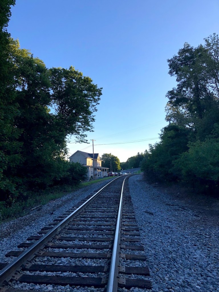
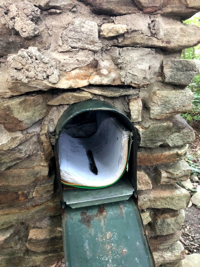
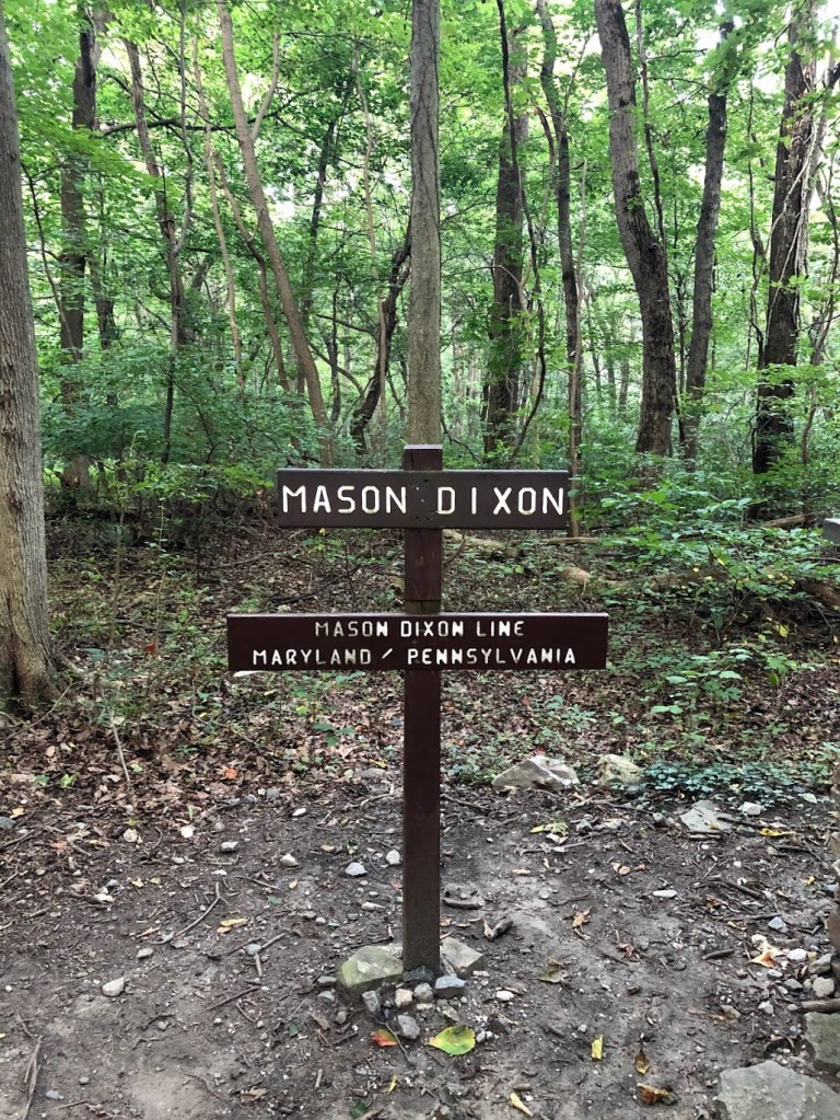
Once we arrive at Pen Mar Park, a really lovely looking place to have a picnic and let kids run around, the hike down to the Mason-Dixon line marking the start of the Pennsylvania section of the trail. It was a cool morning, but the walk down the gravel road and then over train tracks got enough blood pumping that a jacket wasn’t necessary. At the Mason-Dixon line, there is a mailbox with a notebook where hikers leave the date, their names or trail names, and why they are hiking. As I was writing our names, Henry suddenly declared his trail name — for the next five minutes — was going to be Sunshine, which is why his name is crossed out and Sunshine written above.

So how does the Appalachian Trail Conservancy describe Pennsylvania?
“Pennsylvania’s nickname is “Rocksylvania,” but it’s not all rocks. The A.T. in Pennsylvania is famed for its rocky terrain, especially on the long, flat ridges north of the Susquehanna River. The southern part of the state offers some of the gentlest, smoothest terrain of the entire A.T., including the Cumberland Valley.”
Appalachian Trail Conservancy
That’s right! Rocks again! And boy were they right. I still take umbrage with the idea that we are hiking the “smoothest, gentlest” part of the trail right now. The ATC goes on to talk about steep ascents and descents, especially along the Susquehanna, and trail highlights like the “half-gallon challenge” which we will talk about, fingers crossed, later this year.

I found that this section of the trail was really interesting in that we passed a lot of landscapes and “things” (I guess) that we hadn’t seen yet so far. After crossing Falls Creek, we passed this little plastic shoe box that used to be filled with “Trail Magic.” Apparently people will leave these boxes on the trail and keep them stocked with first aid supplies, food, or other goodies. There wasn’t anything in this box except maybe a couple band-aids and a broken lighter left nearby.
Most of the time, we were deep in the woods, but this part of the trail had us crossing several streets and two-lane highways. The weather remained on our side with cool breezes and not too much humidity. Like the weekend before, there were lots of people out and about on the trail, probably having their last family outing before school started again. We leap-frogged a large family a couple times who loved to stop and chat with one another and then run and pass us again.
There were two places on this hike with really steep elevation. The first happened early on to get us back up the mountain at about mile four, and then later at mile eight we had a second steep ascent. One thing we talked about while hiking was whether we liked going uphill or downhill better. Henry was firmly for downhill, but I decided I like going uphill better. Sure, I can barely breathe and it’s fairly miserable, but I like knowing that when I put my shoe down it’s not going to slide out from under me. Going downhill I feel off balance and more of my energy goes into making sure I’m not going to fall and no one behind me (like a husband) is going to slip and knock me down.

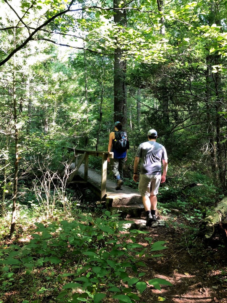


We struggled to find a place to stop and eat lunch, but I’m really glad we kept waffling. Around mile seven we walked into a campground called Old Forge Picnic Grounds, except it took us a minute to realize we were at a campground. We saw a few families up and about playing frisbee or setting up campfires, and I suggested we sit on one of the wooden bridges that allowed for easy creek crossing. But when we stepped on the bridge and it gave way just a little too much for comfort, we moved on. Then, we came across six big rocks, but a few were crawling with ants. Finally, the trail spat us out onto the actual picnic grounds complete with (drumroll) picnic tables!
Being able to actually sit at a table, no matter how damp or how much the paint was peeling, was really nice. Considering last time we just sat on the trail on a few rocks (and a spider crawled into my lap! Gah!), this was a huge improvement. The park even had a small privy, and when I say “privy” that is what I mean. There was one outhouse style toilet in a small building with no running water. I have never felt more grateful to be wearing a mask in my life because that room was not well-ventilated. But anything beats going to the bathroom while out in the woods.
Our second ascent was easier than the first and the rest of the trail was actually fairly gentle. There weren’t as many rocks to navigate as there had been in northern Maryland, and in small sections the dirt path was wide enough to walk two abreast.
We passed a place called Chimney Rocks but didn’t stop to see them. At that point we were only two or three miles away from air conditioning. After looking at pictures on Google Maps, Chimney Rocks is a few large boulders stacked on top of each other that look out over a valley. I’m definitely starting to become more cynical because my reaction to seeing those pictures is “been there, done that.”
Our hike ended abruptly when we stepped onto Swamp Road, which came up faster than I expected. When I parked the car, I had no idea we were actually parking on an AT crossing — I assumed we would have to stop hiking and then walk a ways before getting to it. But there it was, parked on the side of the road staring at a sign that said “Appalachian Trail: Maine to Georgia.”
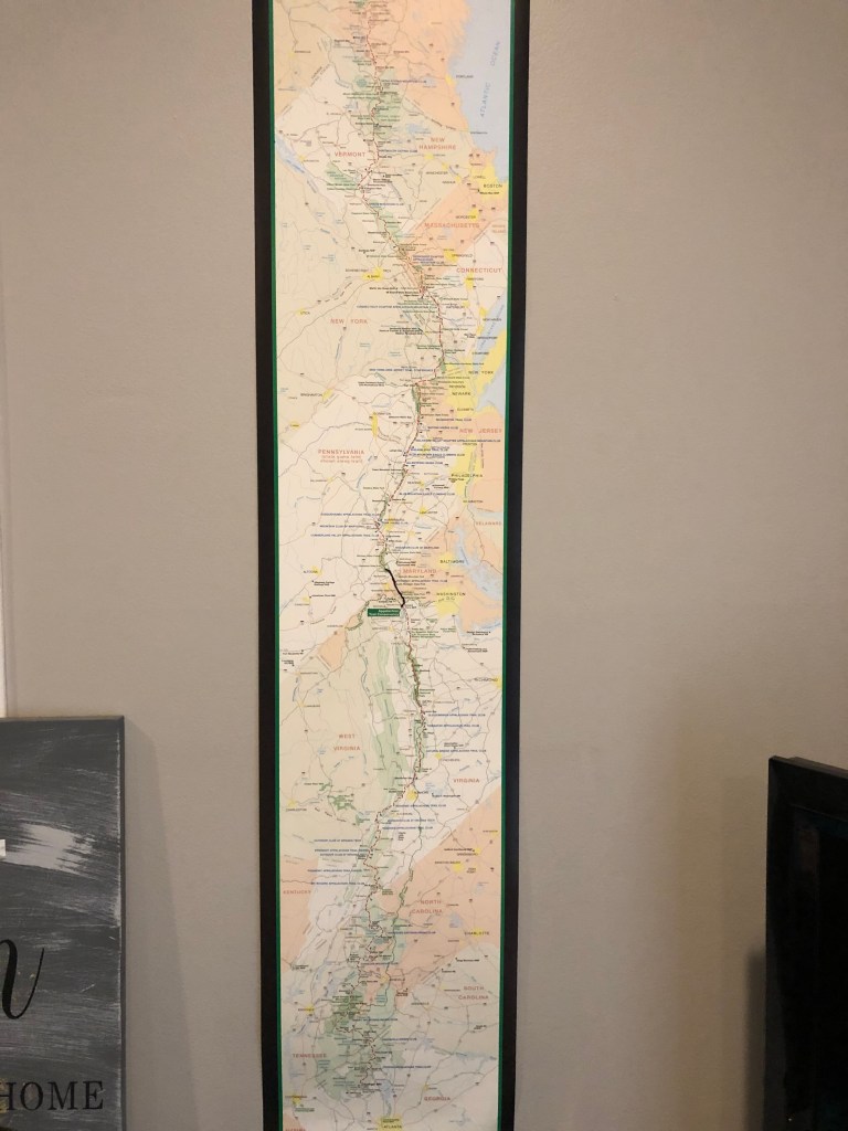
After this stretch of trail, we officially have walked the trail in three states: a little of West Virginia, all of Maryland, and now about 13 miles into Pennsylvania.
In other news, this week our air conditioning broke and will remain broken for the next several weeks (thankfully our landlord had mercy and installed window units), I started teaching 7th grade English at a new school, and Luna will get her teeth professionally cleaned on Wednesday.


| Miles Completed | 55.9 |
| Miles to Go | 2134.1 |
| Percentage Complete | 2.6% |