On the morning of this particular hike, we noticed how long and straight the trail was supposed to be. In fact, while driving to the end point at Clarks Valley Road, I looked to my right and saw the ridge that we would be hiking along. From the ground, it looked flat and consistent, but I knew in my gut it would be all boulders. And there is something to say about the demoralizing realization that you can drive from the start point to the end point in 20 minutes, but it’ll take you six hours to walk. At least, from my vantage point, it seemed level. Oh how wrong I was.
It was chilly when we got out of the car back at the Park and Ride. I looked out over the bridge we had crossed two weeks before and wondered how many hikes we would take between now and the next time we hiked through a town. Since most of the AT is on protected land, very little goes over public roads, and we had already done quite a bit of that in Pennsylvania.
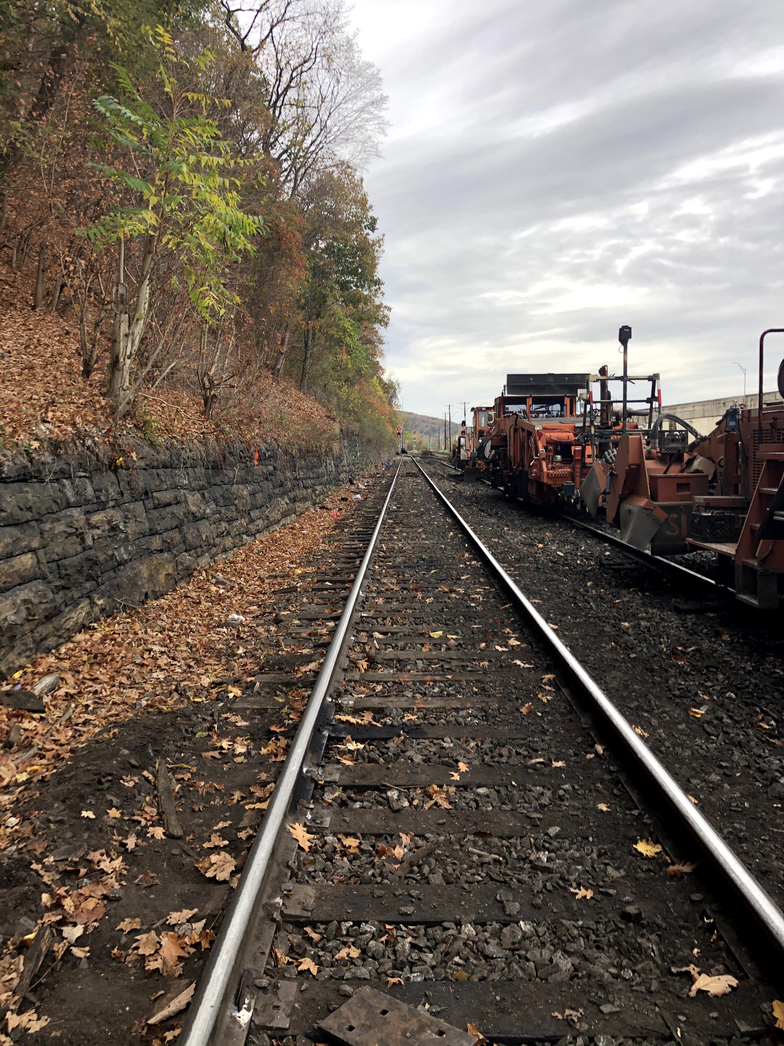
After our customary picture, we crossed the street (an off-ramp from a highway, be swift) and then immediately picked our way over the Norfolk Southern Railway line. The railway seemed to wrap its way around the base of the ridge, which was canvassed in deep yellow and orange foliage. For the third weekend in a row I said, “The colors won’t be like this for much longer. I think this has got to be the peak for fall colors.”
We knew going into the hike the incline would be the worst right at the beginning. Starting from the Susquehanna River essentially and then moving straight up to the top of an unnamed ridge that follows Clarks Valley Road and sits North of the Dehart Reservoir. It was a tough, slick climb up. We didn’t talk for about the first two miles as we carefully navigated rocks, fallen leaves, and easy-to-lose-the-trail switchbacks. At one point I just kept going straight without realizing the trail had turned. Stay alert, people!


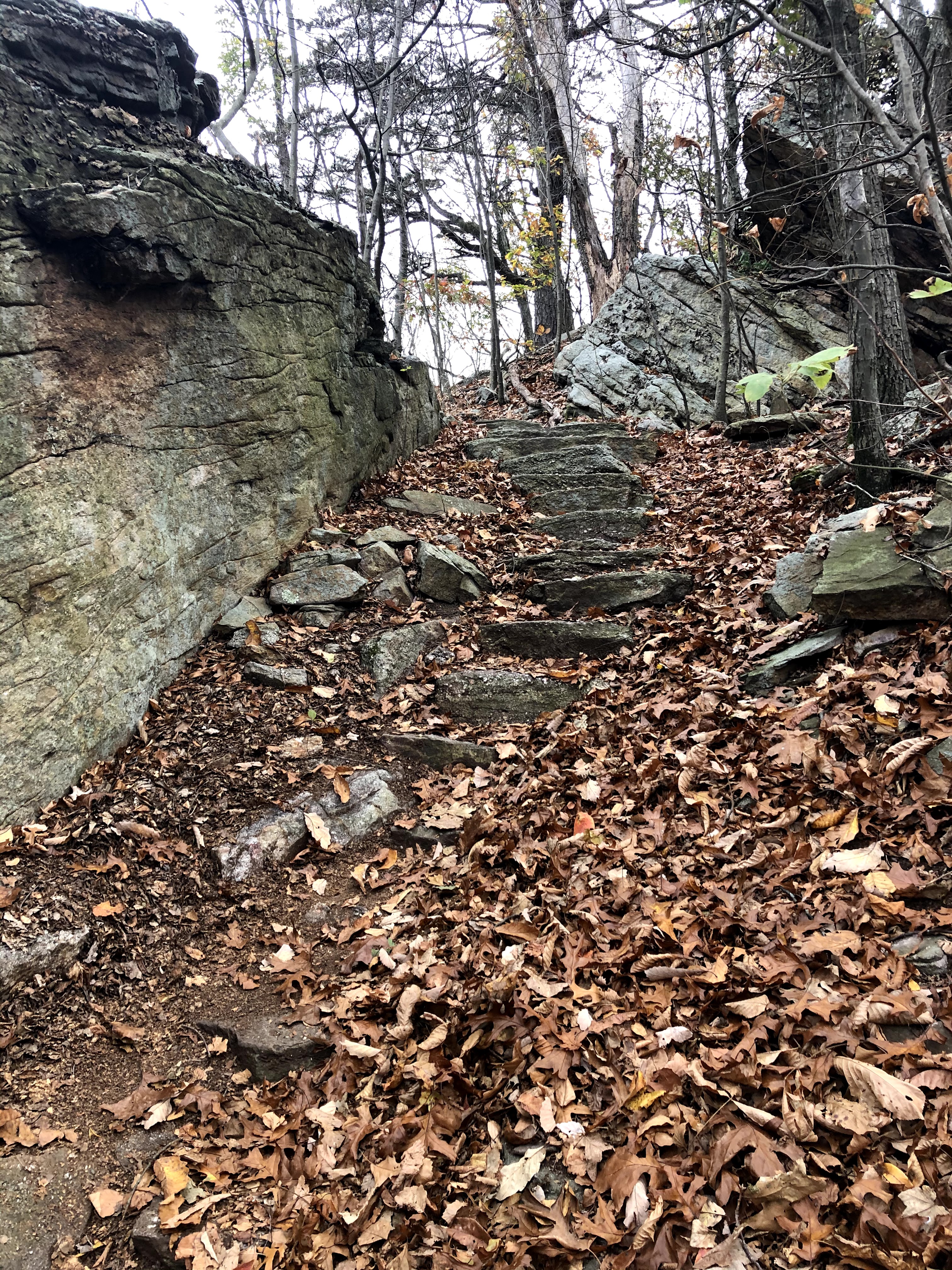

Fall is lovely in the woods, but it really does make hiking in a place like Pennsylvania so much harder. Because most of the trail is just hopping from one small rock to the next and praying that that particular rock is embedded deep within the earth and not resting on top of it, when the trail is covered in leaves who knows just how deep the holes are between the stepping stones. More than once I perched on a stable rock because I wasn’t sure what my next step forward was going to be.


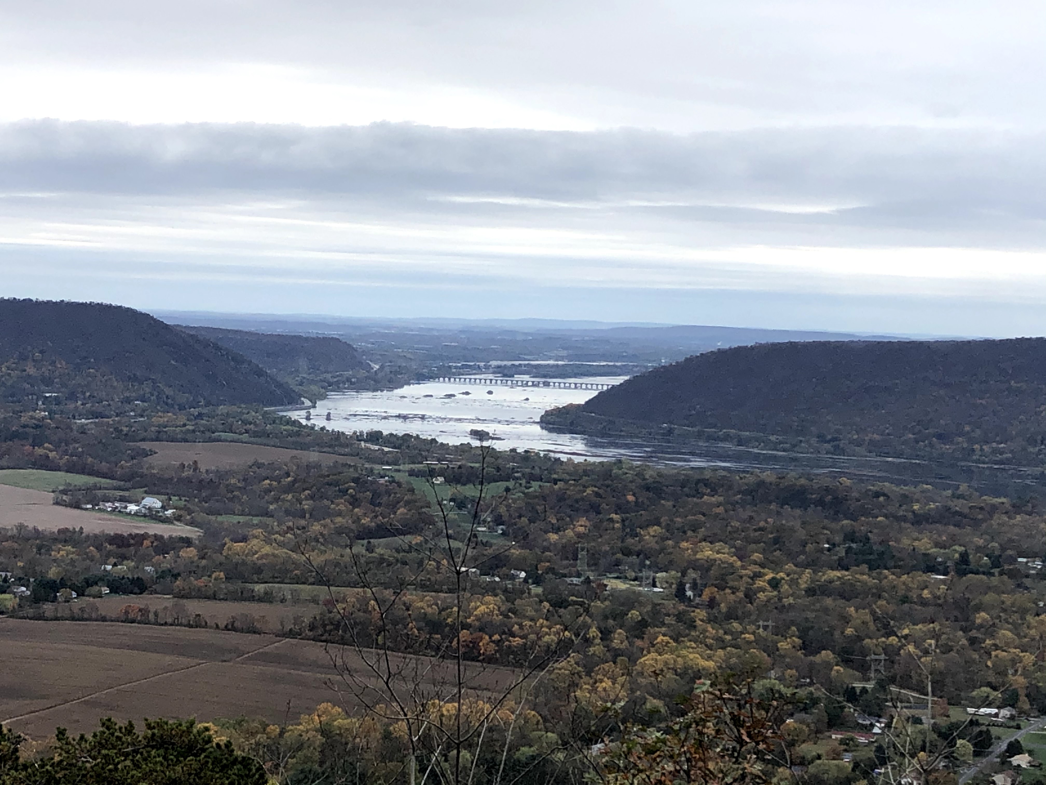
After about two miles, we reached that lovely part of a climb where finally, at eye level ahead of you, you can see sky. No longer do you have to stick your chin up to the sky — you can see the sky through the tree trunks and not up through the leaves. And just as we were cresting the top of the hill…
It began to rain. Not intensely, not enough even to worry me. If I had been walking Luna at home and it began to drizzle like it did on our hike, I would have kept going without opening my umbrella. But with 14 miles to go and on top of a rocky ridge in 40 degree temperatures, a drizzle was a bad omen. The sky was grey and I had to keep putting on and taking off my gloves in turn as my hands got either too cold or too hot. When it had been drizzling for about ten minutes, Henry said, “Why don’t we just get our ponchos out?”

These ponchos are something, my friends. They are gigantic, like a cape Catherine Earnshaw might have worn while walking the moors with Heathcliff. They’re what I might purposely wear to embarrass a future child who is hanging out with their teenage friends. As Henry told me later, he kept imagining me as a dementor from Harry Potter, with my feet levitating a few inches off the ground (because that is where the hem of the poncho was).
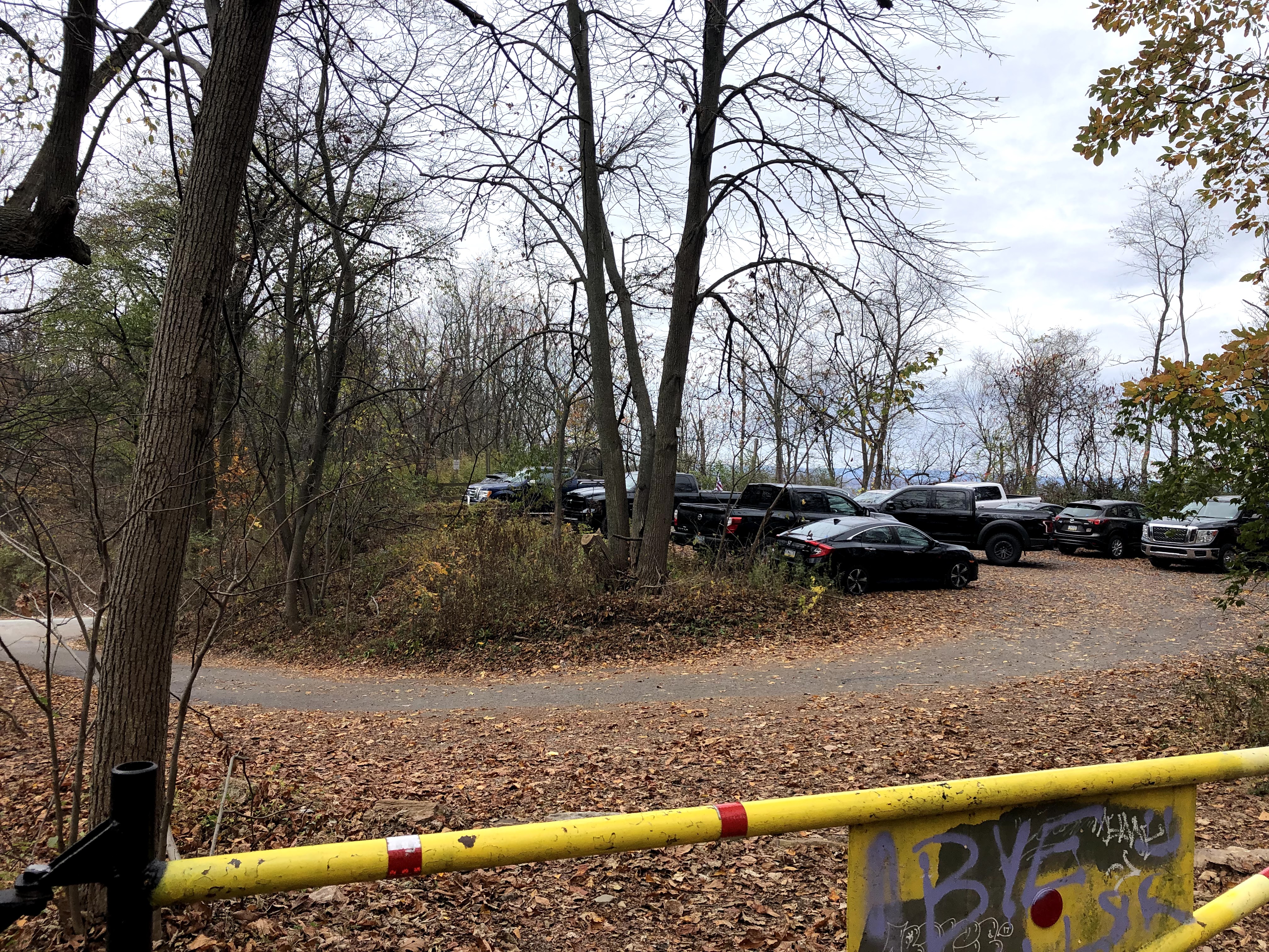
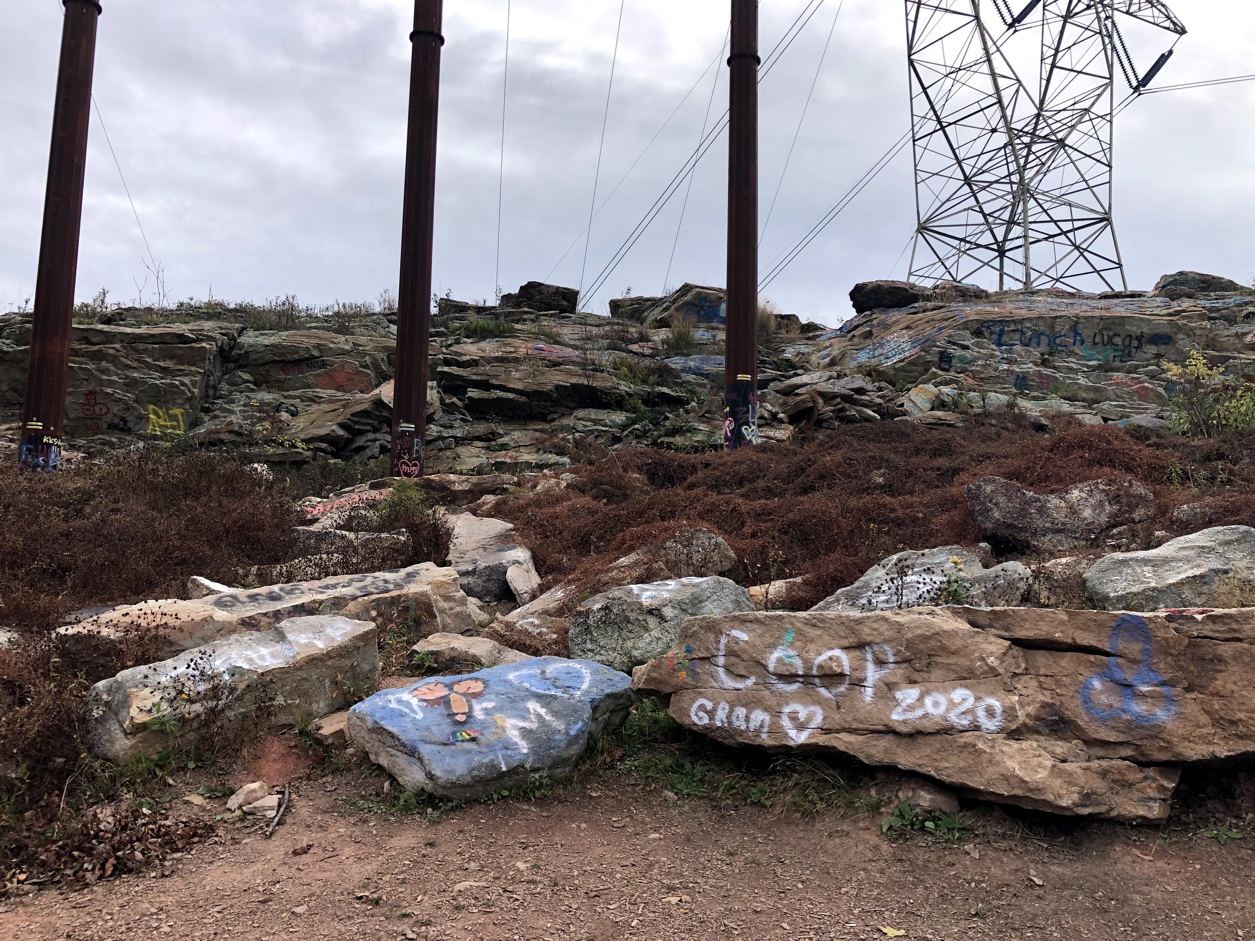
It was good that we did put our ponchos because the drizzle did not stop. When we stopped for lunch it was because we amazingly came across a parking lot. We were so high up on the ridge I had no idea roads could even get up there. We crossed a bridge and towards the back of the parking lot were two flat rocks perfect for eating peanut butter and jelly sandwiches on. After lunch, we found the trail again, made quick work of a fairly steep climb, and came across these lovely, erm, painted rocks.


While from my car earlier it looked like the ridge was flat, it wasn’t. It was a series of small peaks and valleys that continued for 12 miles before a steep descent back to our car. Along the way we saw some deer, ate some sandwiches, and were generally miserable. For the entire second half of the hike, I don’t think we more than huffed and puffed in each other’s directions, let alone have anything resembling a conversation.
And honestly, that was about it. We walked up the hill, along the hill, and down the hill. If we hadn’t have worn our ponchos we would’ve been soaked. Between the constant up and down, the rain, and the difficult footwork, 14 miles took us 8 hours — less than two miles per hour. Despite the smiles at the end, we were really sick of this hike.
Because I’m late writing this blog, dear readers, I’m chuckling at the fact we thought this was a hard hike. Next week’s is a whole different ball game.
| Miles Completed | 145.5 |
| Miles to Go | 2044.5 |
| Percentage Complete | 6.6% |
